Friday, May 14, 2010

4-20 through 4-29-10: The Galapagos Islands, Ecuador

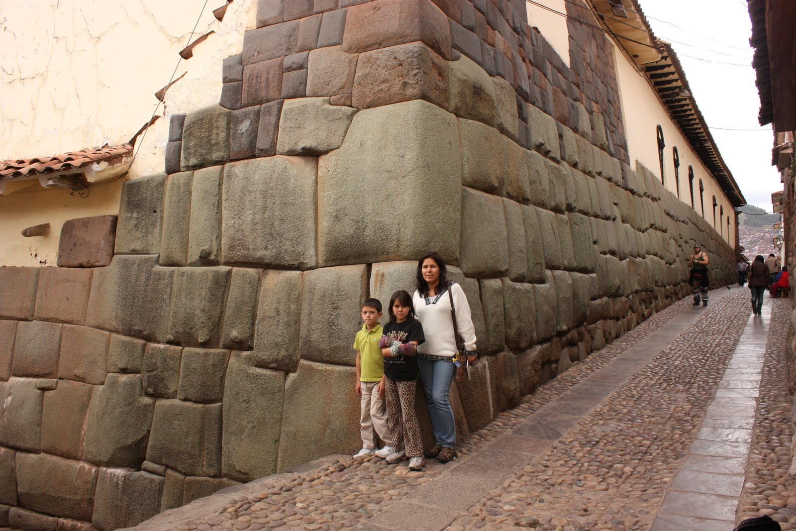
4-20 through 4-22-10: We left Cusco, Peru en route to Quito, Ecuador. We spent a few days in Quito attempting to line up a good deal on a land-based tour of the Galapagos Islands. We decided a land-based tour would be better for us and that it supports the local economy of the islands better than cruises do. We would travel to 4 islands over an 8-1/2 day period staying in hotels and going out on daily excursions by land or boat to various attractions. This was going to be the grand finale for our year abroad and we were thrilled to end it this way.

4-23-10 (Day 1 San Cristobal Island, Galapagos): We flew from Quito to San Cristobal to begin our adventures on this beautiful, hot, humid archipelago. Interestingly, the Galapagos Islands are the only place you can see penguins north of the equator, submarine reptiles, and cormorants with flippers. Our guide met us at the airport and transported us to our hotel. After lunch we visited the Charles Darwin Interpretation Center and from there we stopped at Playa Man so we could play in the ocean the rest of the afternoon.

4-24-10 (Day 2 San Cristobal Island, Galapagos): Today’s agenda included a boat tour to Isla Lobos, Kicker Rock, and Manglecito Beach. On the way to these various sites we saw blue-footed boobies, Galapagos penguins, and frigatebirds. At Isla Lobos, we were able to snorkel with friendly sea lions swimming in our midst as we looked for interesting sea life. The sea lions were very curious and would swim right up to you then swerve away at the last minute. We moved on to Kicker Rock named for its shape; two large barren rocks rising out of the ocean that resemble a boot. Here, Mike and a couple of other members of the tour went scuba diving while the rest of the group snorkeled the channel between the 2 rocks. The bottom of the ocean was 65 feet below us (where the divers went); this was the deepest water the kids have snorkeled! We saw lots of colorful fish, a school of eagle rays traveling together, Galapagos sharks, and sea turtles. In addition to what the snorkelers saw, the divers were able to see hammerhead sharks and also an octopus. We ended the excursion at Manglecito beach were some of us walked the beach while others snorkeled in the bay looking for baby sharks that like to rest along the ocean bottom there.

4-25-10 (Day 3 San Cristobal Island, Galapagos): Today we headed into the highlands by car to La Galapaguera de Cerro Colorado; a tortoise preserve where these gentle giants roam free. Next we visited El Junco, a freshwater lake located in the crater of an old volcano; it is the only freshwater lake on the island. We learned that frigatebirds’ feathers don’t have the oily protection that most sea birds have so they must either skim the surface of this freshwater lake or fly up in the clouds to wash off accumulated salt from their feathers. We saw a couple of frigatebirds flying over the lake going through the cleaning process. Another interesting fact about frigatebirds is that they can’t dive for their food like other seabirds (due to not having the oily protection on their feathers) so you will see them trailing other birds, like the boobie, waiting for the moment to steal their catch. We also saw how introduced or invasive plant species like the blackberry compete with the endemic plants and overtake the land. The last stop was Frigatebird Hill (Cerro de las Tijeretas) and snorkeled in Tijeretas Bay. We saw sea turtles and a purple octopus. There was a statue of Charles Darwin above the bay marking the spot where he first landed in the Galapagos on September 15th 1835.

4-26-10 (Day 4 Isabela Island, Galapagos): The family flew to Isabela (the largest island which has the shape of a seahorse) were we met our new guide, Zolange. We took a boat ride to Tintoreras where we snorkeled looking for reef sharks resting along little nooks on the sea floor. We also spotted marine iguanas and sting rays. Upon returning to town, we rented bikes and rode to the tortoise hatchery then to the Wall of Tears. This wall was erected by convicts in the first half of the century when that area served as a penal colony. Many prisoners died during the work and the construction earned its infamous name Wall of Tears or Muro de las Lagrimas. We returned to town after a long day of sight-seeing and biking. The dirt road had several sandy spots along our route that caused Gaby and Luke to each take a tumble near dusk, ouch. Accidents aside, the ride was neat because we saw several wild tortoises and a couple of marine iguanas next to the dirt road.

4-27-10 (Day 5 Isabela Island, Galapagos): Today we rode on horseback to Sierra Negra Volcano. Sierra Negra is the 2nd largest volcano in the world. Our horses weren’t well-trained at all though. We had a horseman at the rear of the group that would fling his rope at the horses’ rumps to spur them on which would cause the rear horses to ride up on the lead horses that weren’t maintaining a good pace. Gaby and Luke enjoyed it when their horses would begin galloping ahead but then Dad would tell them to keep the horses from passing his ‘lead’ horse. Mike told the guide they were great vacas (cows) because they acted more like cows being herded from the rear by the rancher LOL. On the return trip from the volcano, we passed 2 men who had been out hunting wild pigs and had them in bags on their horses. After returning to our hotel, the kids and I relaxed and swam at Playa Grande which was immediately in front of our hotel. We enjoyed playing in the surf and building sand castles/structures on the beach. The beach was protected from the open sea and the sea bottom was level for a good distance so I wasn’t worried about the kids getting dragged out to sea.

4-28-10 (Day 6 Isabela Island, Galapagos): We traveled south of Puerto Villamil and headed by boat towards the southern tip of Isabela to an area known as Los Tuneles (The Tunnels). This is where the hot molten lava reached the cool Pacific waters and cooled instantly to form a series of tunnels, bridges, and other interesting lava formations. It is one of the most interesting snorkeling destinations in all of the Galapagos. To get to Los Tuneles, our boat had to surf large waves as it entered a narrow channel to reach the calm waters beyond. We walked along some of the lava formations and saw blue-footed boobies performing a mating dance among the numerous cacti. We snorkeled and saw various fish, sea turtles, a shark, a huge manta ray, and sting rays.

4-29-10 (Day 7 Santa Cruz Island, Galapagos): We traveled by ferry boat (our guide included) to Santa Cruz. A trip to the highlands was in store for us; we visited another tortoise reserve followed by an underground hike through a lava tube. At one point, we had to crawl on hands-and-knees to get through the narrowed opening. The lava tube formed when the outer lava layer cooled off 1st while the molten lava continued to run its course through the middle thus leaving behind an empty chamber. Another attraction was Los Gemelos (The Twins), 2 large sinkholes where the earth collapsed secondary to a chamber located beneath likely filled with gas. Next we went on a boat tour of Tortuga Bay. Everyone went snorkeling again except Gaby who wanted a break from the constant snorkeling! After snorkeling we hiked to a local, popular swimming/diving spot called Las Grietas. It is a small canyon no more than 25 feet wide with a deep pool filled with cool brackish water. Divers would jump from varying heights to land in the pool; if their nerves and skills allowed them to. We saw a brave or dumb diver, depending on how you think about it, jump from the top (about 65 feet) and land effortlessly into the water. Mike and the kids managed to jump from an astounding height of 10 to 15 feet!

4-30-10 (Day 8 Floreana Island day trip, Galapagos): The kids and I traveled about 2-1/2 hours to the island of Floreana while Mike stayed behind to scuba dive at Gordon Rocks. He was lucky enough to see several sea turtles and hammerhead sharks up close(see videos). During our boat trip, Gaby, Luke, and I were fortunate to see 2 dolphins jump out of the water; the kids definitely thought that was cool. Upon arriving at Floreana, we took a car up to the highlands to see more tortoises and old pirate caves. After lunch on the island, we went by boat to look for penguins, sea lions, and birds at various rock islands in the ocean. Our last stop was at a little bay called Champion so we could snorkel with sea lions and their pups. We had a wonderful time swimming with them; it is amazing how curious and unafraid they were of us (I should have bought one of those cheap Kodak underwater camera the day before because the photo ops were awesome!). Gaby would retrieve a shell from the bottom of the bay, drop it, and watch a sea lion retrieve it and continue playing with it; this is why they are known as the golden retrievers of the ocean.

5-1-10 (Day 9 Santa Cruz Island then return to Quito): The family visited the Charles Darwin Research Station in the a.m. The station featured an info center, a museum, and a tortoise enclosure where you were able to meet these Galapagos giants face-to-face. Lonesome George was also found here with the 2 females that they want him to breed with to salvage his sub-species (there are a total of 11 Galapagos tortoise sub-species). He is the last of his line and the 2 females are of a sub-species that are the closest to to his DNA makeup. So far Lonesome George has been unsuccessful in breeding attempts and it is unknown why he isn't interested in mating. Afterwards a car drove us across the island to take the ferry that crosses the canal to Isla Baltra where the airport is located. After a short bus ride to the airport, we boared our return flight to Quito. We spent the night in Quito and prepared our luggage for our flight tomorrow to Orlando, Florida.

A CHANGE IN ITINERARY: We decided that the Galapagos would be our last trip in South America instead of staying through the end of May as originally planned. Mike and I chose to take the kids to Disney World in Orlando the 1st week of May as a reward for being awesome world travelers. Next we would visit both sides of the family before returning to normal life in Colorado June 1st. A great way to end a wonderfully amazing, sabbatical year!!! THE END/FIN

Tuesday, April 27, 2010

4-12 through 4-19-10 Cusco, Peru and Lares Valley to Machu Picchu trek (1st 5 pics taken in Cusco then Lares Valley trek to Machu Picchu)


4-12 through 4-19-2010: We arrived in Cusco; a lovely, albeit, touristy city at an altitude of 11,200 feet. It had lots of plazas with fountains, lots of old churches, and remnants of Inca walls downtown.

On 4-12, we visited the Museo Inka which has the best collection of Inca artifacts in Cussco. It also gave a good background on Andean environment and history: the casa of antepasados (house of the ancestors) was interesting. Mummies were housed behind a display that had glass windows looking into the ‘house’ as well as eerie red lighting. We also saw indigenous people weaving textiles by hand using a wooden loom and an artist that crafted small sculptures and other objects using granite stone from the Machu Picchu area. One sculpture we liked especially showed the 3 worlds of the Inca; the condor which represented the spirit or future world, the puma which represented the present or physical world, and the serpent which represented the past or underworld.

FYI: Cusco has been continuously occupied for at least 2000 years and claims to be the oldest city in the Americas. Cusco has an altitude of 11,150 ft and is surrounded by even higher mountains. The Incas constructed the city in the shape of a giant puma.

(4-13 through 4-16-10) On 4-13, the family began a 4 day/3 night Lares Valley trek with a final destination of Machu Picchu. A private car drove us from Cusco, through Urubamba, Calca, and to Lares where we soaked in mineral hot springs and had lunch before beginning our hike. We hiked 8 km in 3-1/2 hours with a 1600 foot climb to our 1st camp at Huacahuasi.

The next day (day 2) we ascended 2000 ft to cross Paso Ipsaycocha (Ipsaycocha Pass) at an altitude of 14,400 feet (our highest point of the trek) then descended 2000 feet to our 2nd camp at Patacancha (the hike was 12 km and about 5-1/2 hrs). Our guide, Henri, had advised us before starting our trek to buy a couple packages of pencils since the indigenous kids flocked to the trail hoping to get ‘caramelos’ (candy) from the passing tourists, but pencils were a better option and more practical.

Day 3 involved a 5 hr, 12 km descent to the town of Ollantaytambo where we took a 1-1/2 hr train ride to the town of Aguas Caliente (town outside of Machu Picchu).
The next morning (day 4) a guide gave us an informative 2-1/2 hr tour in Spanish. We spent additional time exploring the ruins and walking to the Inca drawbridge; the trail hugged the cliffside with steep drop-offs. Luckily, the drop-offs were obscured by clouds (the weather was rainy and cloudy) and vegetation so the fear of heights factor wasn’t a problem. The architectural techniques and building designs of the Incas was spectacular.

Machu Picchu Facts: It is situated in the highland jungle at an altitude of 2432m (7972 feet). Th most common stone found in the region is grayish-white granite which contains high quantities of quartz, mica, and feldspar thus making it relatively easy to shape. Therefore, the rock was a magnificent building material for the Inca masons.

4-18-10: The family walked around Cusco looking at remnants of Inca walls, the architecture of colonial churches/cathedrals, remains of an Inca temple (Koricancha), and the polygonal stone walls of Hatunrumiyoc’s palace which has the famous 12-angled stone. In the neighborhood of San Blas, we stumbled upon the Museo de la Coca; a small, private museum dedicated to promoting knowledge and understanding of the Inca’s sacred leaf. We saw an interesting chart listing the numerous vitamins and minerals coca has along with its medicinal properties. Its use was also interwoven in all facets of the Inca lifestyle and its use and importance continues in the present day indigenous descendants of the Incas.

Saturday, April 17, 2010

3-29 through 4-11-10- Our stay in Sucre, Bolivia ends


4-2 through 4-4-10: Our last 2 weeks in Sucre were relatively uneventful; the highlight was a trip into the mountains outside of Sucre to Aritumayu Ecolodge. A lodge employee picked us up in an old Toyota Land Cruiser. The road to the lodge was very bad secondary to erosion but it led to a beautiful lodge with lots of trees that the owner had planted 20 years ago to help reforest the area. The lodge didn't have electricity so we used headlamps, candles or kerosene lamps at night. We hiked to an aqueduct built in the 1900s that still carried water to Sucre (via a pipe currently instead of the water running along the top). Aritumayu is Quechua for 'closed river' due to the secluded nature of the area where a river runs through the property.

We took a short horseback ride around the mountains and took in the beauty of the canyons and waterfalls. The kids enjoyed riding and hanging out with the horses; the horses were able to freely graze on the lodge property but the owner (Don Jose) would shoot small rocks at them with his slingshot if he saw them munching from the flower garden area.

Since we were at the lodge Easter weekend, Mike and I brought up foil-wrapped chocolate candies for an improvised Easter egg hunt in the flower garden. We left late Sunday around 7 p.m. to return to Sucre. There was a restriction on car traffic in Sucre until after 6 p.m. due to voting for the city elections (having them on Easter Sunday didn't make sense).

4-9-10: Mike and the kids finished their studies at Bolivian Spanish School and they received certificates. Everyone was sad to say goodbye.

4-10-10: We sadly bid goodbye to our landlady and friend Rosita and her dear dog Spot and hopped on an overnight bus heading to La Paz, Bolivia. La Paz is located at an elevation of 3,660 meters making it the world's highest capital city. The city sits in a "bowl" surrounded by the high mountains of the altiplano. As it grows, La Paz climbs the hills, resulting in varying elevations from 3,000 meters to 4,100 meters (9,840 ft to 13,450 ft). Overlooking the city is towering, triple-peaked Illimani which is always snow-covered and can be seen from several spots of the city.

We found lodging in La Paz the next morning upon arriving, rested, then headed out to explore the town of Tiwanaku and its Pre-Colombian archaeological site of the same name (75 km outside of La Paz). Tiwanaku is recognized by Andean scholars as one of the most important precursors to the Inca Empire, flourishing as the ritual and administrative capital of a major state power for approximately 500 years. We enjoyed touring the on-site museums and marveling at the ruins and stone statues. We saw areas that were actively being surveyed for future excavation.

4-11-10: We took a plane out of La Paz this morning headed for Cusco, Peru. It was a short 1-1/2 hour flight; it beat taking the bus for 17+ hours. The La Paz airport is the highest airport in the world with an altitude of 13,323 feet. Tibet in the Republic of China has the two highest airfields in the world; Bangda airport (15,548 feet) and Lhasa airport (14,315 feet). Mike noticed that the runway was very long (2.5 miles actually) and that the plane took much longer than usual to achieve lift-off due to the low air pressure at this elevation.

Monday, April 12, 2010

3-21 through 3-28-10 Pujllay festival in Tarabuco, Bolivia


3-21-10: The Pujllay is a traditional celebration that occurs annually every March to remember the Battle of Jumbati. This crucial battle took place on March 12, 1816, 50 kilometers outside of the city of Sucre. Indigenous soldiers, led by indigenous leaders, overcame the Spanish during the fight for independence. The festival takes place in the town of Tarabuco, not far from the battle site. The souls of the soldiers who died in the battle are honored.

Another part of the Pujllay celebration involves the Pucara which is a magical-religious symbol in the form of a large ladder which is decorated with flowers, fruits, drinks, and agricultural products of the region. It is erected in an open area as an offering to the deceased and groups of indigenous dancers dressed in colorful, traditional costumes dance around the Pucara.

The Tarabucan people often wear leather hats called “monteras” that are fashioned after the helmets of the Spanish conquistadors. During the Pujllay, this hat is adorned with flowers (sometimes made of cloth). The attire of both male and female dancers is quite elaborate. The men wear platform sandals called “ojotas” that have large decorative spurs attached. The sound of the spurs, as well as the sound of the bells attached to broad belts worn around the waist, contributes to the music produced by wind instruments, the toqoros, senq’as and wajras.

3-26-10: Gaby and Luke have been participating in late afternoon workshops Mon.-Fri. for 2 weeks now to increase their interaction with Bolivian children. Although they resisted initially, they have been enjoying the different workshops and have been conversing with their teacher and the other kids in Spanish. Their teacher is from France and her Spanish has a strong French accent but it doesn’t seem to be a problem for the kids in her classes. The workshops include math and word games, art class, as well as board and team games.

Wednesday, March 24, 2010

3-7 through 3-20-10 Sucre, Bolivia (pics from mirador and Recoleta convent, our temporary home, Parque Cretacico, Museo Charcas)


3-8-10: Sucre Facts: It is called la cuidad blanca (white city) due to the number of white buildings that they showcase with spotlights at night. It has an altitude of about 9,200 feet and temperate weather (mean of 64 degrees F). It is a popular city for tourists seeking to study Spanish or volunteer. Sucre is also famous for its tapestries; different indigenous tribes/family groups from the villages surrounding Sucre all have their own unique style, which is shown in their work by using different colors/symbols. Some handmade tapestries can take up to a year for 1 person to weave, depending on the size and complexity of the piece. Women are typically the weavers of the finer tapestries.

3-13-10: The amazing Parque Cretacico, also called Cal Orck’o (hill of lime), is located 5 kilometers outside of Sucre at a cement factory plant. It was discovered in the still active limestone quarry in 1994. It is the site of the world’s largest collection of dinosaur tracks. The tracks are embedded into a 70 degree wall of limestone, which used to be a lake floor, and thanks to tectonic movement was raised up as the current wall. The discovery of the footprints provided evidence that for a brief time interval before extinction, the diversity of dinosaurs was much larger than previously thought. The wall features about 5,055 individual footprints of at least 6 dinosaur species. The park has 24 life-size dinosaur replicas which includes 12 species of dinosaurs that lived together near the end of the Cretaceous period.

3-14-10: The family visited Villa Norita which is 20 minutes outside of Sucre in the countryside. For the low price of 35 bolivianos (5 U.S. dollars)/person, you could enjoy a delicious 2 course lunch with dessert and take a dip in the pool. Mike and the kids went for a swim, luckily, before we saw a young boy take a pair of underwear to the pool edge and dip them in the water and begin scrubbing them vigorously. Our desire for further swimming that day was extinguished after witnessing that event! Our bus ride back to town from Villa Norita was also an adventure. The bus was roughly a foot longer than our Honda minivan back home in Colorado but we squeezed into the nearly full bus by having Gaby and Luke sit on each of our laps. Amazingly, the bus driver picked up 4 more passengers at the next stop who nonchalantly stood or sat in the ‘aisle’ space; this brought the total passenger count to 24! We made it back to Sucre without further glitches except for cramped legs upon disembarking from the bus.

3-20-10: A visit to the Museo Charcas was a worthwhile and interesting outing today. Before being converted into a museum in 1957, the building and grounds belong to the Spanish Crown and was used for diverse purposes. The museum had 3 areas to explore: the Anthropology wing, the Colonial wing, and the Gallery of Modern Art. We liked the 1st 2 sections the best. The Anthropology section had a collection of objects ranging from approximately 1600 BC up to the Spanish occupation in 1532 AD, as well as physical anthropology and modern ethnography. It included ancient human skulls (regular-shaped skulls as well as skulls in which the cranium was deformed by wrapping the head with bandages or attaching wooden boards to flatten it), ceramic pottery of different indigenous tribes, jewelry, weapons and arrowheads, and pre-hispanic mummified bodies. The deceased were usually wrapped in a blanket and/or placed in a cave thus the dry climate of the area would naturally mummify the remains. The Colonial section had paintings, sculptures, and furniture of that era. The furniture pieces were objects of art as well since many of the wood pieces were ornately carved or inlaid with mother-of-pearl. The museum building, courtyard, and even the large, wooden, front door demonstrated the beautiful Colonial style.